Mapped references to the area now known as Mount Pleasant first appeared in the late 1600s. A 1672 map created for the Lords Proprietors refers to the land surrounded by Charleston Harbor, Shem Creek and Cove Inlet as North Point, while a later undated map indicates it is Oldwanus Point. The earliest known inhabitants of the land were members of the Sewee and Wandoe [sic] tribes. In 1680, the first European who lived here, Florence O’Sullivan, encountered these Indians, as did a group of Congregationalists from New England who settled in the Christ Church area in 1695.
For the earliest settlers, major routes of transportation included the harbor, channels, rivers, inlets and creeks, many of them named by the Indians: Shem Creek, Wando River and Copahee Sound, for example. This heritage also is reflected in street names, such as Oldwanus Drive, Seewee Circle, Shem Drive, Mataoka Street and Wakendaw Boulevard.
Some of the first roads were built as part of a long-distance trail system that included stagecoaches and ferries. Before Andrew Hibben started his ferry service in 1770, residents and travelers had to depart from Hobcaw Point to cross the Cooper River to Charleston.
Old Georgetown Road was an early route between Georgetown and Charleston; a few portions still exist in Mount Pleasant, while others became part of U.S. Highway 17. The road led directly to the ferry landing at Haddrell’s Point. From there, passengers could cross the harbor on Hibben’s ferry, which cut travel time significantly.
The original town of Mount Pleasant was a combination of five villages located between Shem Creek and the cove that incorporated in the mid-19th century and eventually expanded to include all of Christ Church Parish. Now Mount Pleasant stretches from the Cooper River to the Intracoastal Waterway and from Charleston Harbor all the way to Awendaw.
The Old Village includes the oldest and most historic streets, but the tradition of honoring residents who contributed to the town’s growth and prosperity by naming streets, parks and landmarks after them continues today.
Origins for Some of the Oldest Local Street Names
Beach Street – Before the harbor jetties were constructed, this street curved along a sandy beach. Later, with the natural flow of sand obstructed, marsh grasses took over the area.
Bennett Street – This street is named for James Hibben’s mother-in-law, whose fourth husband was William Bennett.
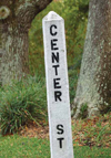
 Center Street – The street was named in the 1847 plan of Hilliardsville, which encompassed the area from Division Street (now McCants) to the cove and from Common Street (now Royall Avenue) to the harbor and was owned by Charles Jugnot and Oliver Hilliard.
Ferry Street – Constructed in 1847, it served as a route to the Mount Pleasant Ferry Company wharf owned and operated by Charles Jugnot and Oliver Hilliard.
Haddrell Street – It was named after George Haddrell, an original settler from the late 1600s who is buried in the churchyard of Christ Church. Haddrell’s Point, the southeast side of Shem Creek, also was named for him. The first Mount Pleasant ferry ran from Haddrell’s Point to Charleston.
Hibben Street – This street was named after James Hibben, whose father Andrew Hibben began the ferry service in 1770. James Hibben was the founder of Mount Pleasant Village and a state senator from 1800 to 1815.
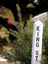
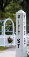
 King Street and Queen Street – These were named by Englishman and landowner Jonathan Scott for the English sovereigns.
Lucas Street – The street was named for Jonathan Lucas, an English millwright who purchased the Greenwich Mill in 1793. It has been reported that he built a combination rice and saw mill powered by water on Shem Creek.
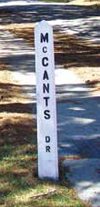
 Mccants Street – T.G. Mc- Cants, mayor of Mount Pleasant from 1928 to 1933, was a member of a prominent family of planters dating prior to the Civil War.
McCormick Street – This street was named after H. L. P. McCormick, who bought out the Mount Pleasant Ferry Company and was intendant (mayor) from 1872 to 1874.
Middle Street – The name of this street was on the 1847 plan for Hilliardsville.
Mill Street – The street originally led to Jonathan Scott’s Greenwich Mill on Shem Creek.
 Pitt Street – The street was named by Jonathan Scott for Sir William Pitt, Earl of Chatham and prime minister of England from 1766 to 1768.
Royall Avenue – The name of this street was changed from Common Street in 1950. The Royalls were prominent planters, and Robert V. Royall served as town surveyor in 1889 and intendant (mayor) from 1898 to 1914.
Scott Street – This street was named for Jonathan Scott, the original owner of Greenwich Village and Greenwich Mill.
Venning Street – The street was named for property owner Nicholas Venning. His father, Col. Samuel Venning, defended the settlement during the Revolutionary War. His relative, Elias Venning, was intendant (mayor) from 1865 to 1866.
Whilden Street – This street was named for Elias Whilden, a landowner and planter appointed to layout the original town with Andrew Hibben, Joshua Toomer and Samuel Venning following Mount Pleasant’s 1837 incorporation. He was intendant (mayor) from 1857 to 1858.
The names on these streets and many others came to us as a legacy from the early inhabitants, landowners, prominent businessmen and community leaders. Of course, the future holds even more growth and change; contribute to that growth and maybe a street will be named after you.
